

Atlas Mountains Map: A Geographic Overview of North Africa
The Atlas Mountains are one of the most significant mountain systems in North Africa, stretching across Morocco, Algeria, and Tunisia. Understanding their structure and location is much easier when studying an atlas mountains map.
This reveals how this vast range shapes the geography, climate, and human settlement of the region. These mountains form a natural barrier between the Mediterranean and Atlantic coastal regions and the Sahara Desert, influencing both environmental conditions and cultural development.
The Atlas Mountains are not a single continuous ridge but a series of connected ranges, each with distinct characteristics. From snow-capped peaks in the High Atlas to the rugged slopes of the Tell Atlas, the system plays a vital role in North African geography.
Geographic Location and Structure
A detailed atlas mountains map shows that this mountain system extends over 2,500 kilometers (about 1,600 miles), forming a curved arc across North Africa. The range is generally divided into three major sections:
· High Atlas in Morocco
· The Middle Atlas is also in Morocco
· Tell Atlas and Saharan Atlas in Algeria and Tunisia
The High Atlas is home to the highest peak in North Africa, Mount Toubkal, which rises to 4,167 meters. This region is especially important because it acts as a climatic divider between coastal Morocco and the Sahara Desert.
The Middle Atlas, located further north, is characterized by forests, lakes, and relatively moderate elevations. In contrast, the Tell Atlas and Saharan Atlas extend eastward into Algeria and Tunisia, gradually transitioning into semi-arid and desert landscapes.
By studying the Atlas Mountains, one can clearly see how the range creates a natural boundary separating different ecological and climatic zones across the continent.
Geological Formation and History
The Atlas Mountains were formed millions of years ago during the collision of the African and Eurasian tectonic plates. This geological activity caused the land to uplift and fold, creating the rugged terrain seen today. Unlike some older mountain systems, the Atlas range is relatively young in geological terms, which explains its sharp peaks and deep valleys.
An atlas mountains map helps illustrate how tectonic forces shaped the region in a curved formation. This arc-like structure is the result of long-term pressure and uplift processes that continue to influence the region today, including occasional seismic activity.
The mountains also contain rich mineral deposits, including phosphate, iron, and other valuable resources, which have played a role in regional economies for centuries.
Climate and Environmental Zones
The Atlas Mountains significantly influence North Africa’s climate. A closer look at an Atlas Mountains map shows how the range blocks moist air from the Atlantic Ocean, creating a stark contrast between lush northern slopes and dry southern desert regions.
The northern side of the mountains receives more rainfall, supporting forests of cedar, oak, and pine. In contrast, the southern slopes descend rapidly into the Sahara, where conditions are arid and vegetation is sparse.
Elevation also affects temperature. Higher altitudes experience cold winters with snowfall, particularly in the High Atlas. This makes the region unique in North Africa, where snow is rare outside mountainous zones.
Because of this climatic diversity, the Atlas Mountains host a wide range of ecosystems, from Mediterranean forests to alpine environments and desert-edge landscapes.
Biodiversity and Ecosystems
The Atlas Mountains are home to diverse plant and animal species, many of which are endemic to the region. Cedar forests in the Middle Atlas provide habitat for the endangered Barbary macaque, one of the few primate species found outside Asia and South America.
An atlas mountain map highlights the ecological zones that support this biodiversity. The variation in altitude and climate allows for different ecosystems to exist within relatively short distances.
Wildlife in the region includes foxes, wild boars, mountain goats, and numerous bird species. Plant life varies from dense forests in wetter areas to hardy shrubs and grasses in drier zones. Conservation efforts are increasingly important as deforestation, overgrazing, and climate change threaten these fragile ecosystems.
Human Settlement and Cultural Importance
Human communities have lived in the Atlas Mountains for thousands of years. Indigenous Amazigh (Berber) populations have historically adapted to the rugged terrain, developing agricultural terraces, irrigation systems, and unique architectural styles suited to mountain life.
An atlas mountains map reveals many scattered villages and valleys where people rely on farming, livestock herding, and small-scale trade. Major cities such as Marrakech and Fez lie near the foothills, benefiting from access to both mountain resources and coastal trade routes.
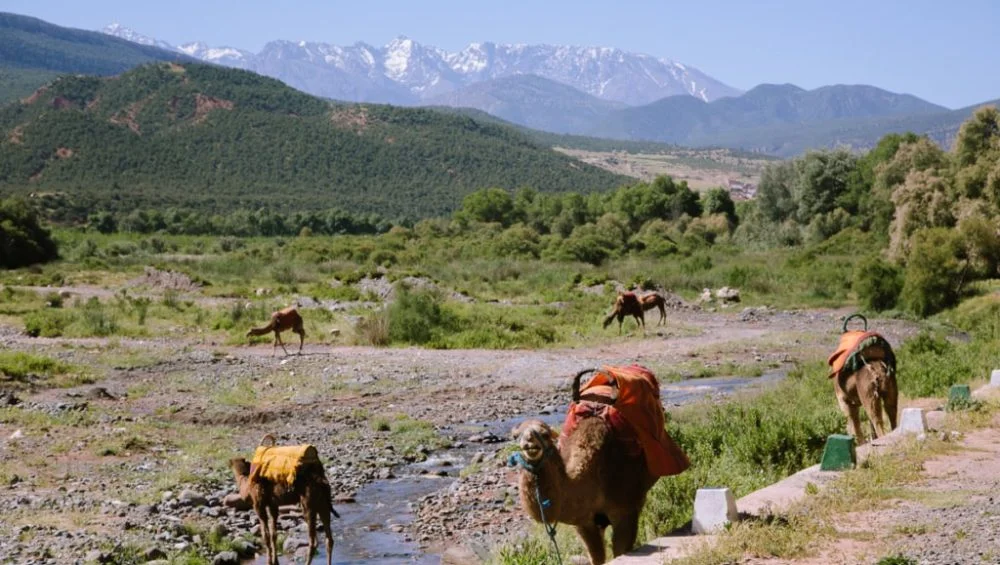
The mountains also hold cultural and historical significance. Traditional music, crafts, and languages of the Amazigh people remain strong in many regions. In addition, the Atlas Mountains have become a popular destination for tourism, hiking, and skiing, especially in Morocco.
Economic Importance
The Atlas region contributes to North Africa’s economy in several ways. Agriculture is supported by river systems originating in the mountains, providing irrigation for the surrounding plains. Crops such as olives, citrus fruits, and grains are cultivated in fertile valleys.
Mining is another important industry, particularly in Morocco, which is one of the world’s largest exporters of phosphate. Hydroelectric power projects also take advantage of mountain rivers and elevation changes.
When examining an Atlas Mountains map, it becomes clear how the range supports both natural resources and human economic activity across multiple countries.
Tourism and Modern Significance
Today, the Atlas Mountains attract tourists from around the world. Activities such as trekking, skiing, and cultural tours are common. The High Atlas, in particular, offers scenic trails, traditional villages, and dramatic landscapes.
Tourism infrastructure has developed in key areas, although many regions remain remote and undeveloped, preserving their natural beauty and cultural authenticity. A modern atlas mountain map is often used by travelers to plan routes through mountain passes, national parks, and historical sites.
Conclusion
The Atlas Mountains are a defining feature of North Africa’s geography, shaping climate, ecosystems, and human life across Morocco, Algeria, and Tunisia. From their formation through tectonic forces to their role in modern economies and tourism, they remain a region of immense importance.
Studying an atlas mountains provides valuable insight into how this mountain system influences both natural and human landscapes. It reveals not only the physical structure of the mountains but also their deep connection to the history, culture, and environment of North Africa.